
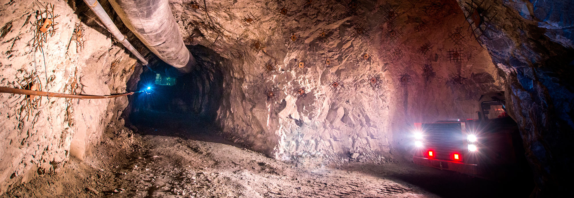
Multifunctional safety system for underground mines and mineral extraction
An effective solution for personnel safety and more efficient business processes in the mine.
Miner Positioning and Collision Avoidance for Industrial Safety in Underground Mines
RealTrac Underground Mining is a multifunctional industrial safety system for meeting industrial safety requirements at underground mineral extraction sites.
The solution determines the location of miners and mining vehicles in real time, prevents collisions, provides voice communications and transmission of data and telemetry, controls traffic lights and helps locate people trapped under rubble. All modules run on a single data network backbone.
Problems we solve
- Vehicles hitting people.
- Vehicle-to-vehicle collisions.
- Locating personnel quickly in emergencies.
- Confirming that no personnel remain in hazardous areas.
- Low personnel efficiency.
- Traffic light control in the mine.
- Searching for personnel after accidents.
- Communications and Wi-Fi underground.
Location monitoring
Real-time location of personnel and vehicles on all mine levels.
Position and movement analysis
Analysis of position, movement and vehicle operation, presence in work zones, working time, falls, immobility and panic button presses.
Collision avoidance
Prevention of vehicle-to-vehicle collisions and vehicles hitting personnel.
Integration
Process control systems (SCADA), fleet management system, electronic work permits, time and attendance, access control system.
Mine dispatching
Higher productivity through dispatching and fleet management.
Shared infrastructure
The data network backbone is reused for voice communications, video surveillance, telemetry and other systems.
Industry standards
EMESRT Performance Requirement 5A (PR-5A) describes how vehicle interaction technology supports the last three of the nine control layers that prevent unwanted vehicle interactions in surface and underground mining: vehicle to person, vehicle to vehicle and vehicle to equipment or environment. The RealTrac Collision Avoidance System (CAS) module of this solution is designed to support the EMESRT PR-5A vehicle interaction control levels 7, 8 and 9.
Level 7. Operator awareness
PR-5A: information on the presence and location of people, vehicles and objects around the vehicle. RealTrac CAS: the in-cab display shows the situation around the vehicle, and the Attention zone warns workers, drivers and operators.
Level 8. Advisory controls
PR-5A: alarms that warn the operator of an imminent collision threat. RealTrac CAS: the Danger and Emergency zones trigger color and sound alarms in the cab and vibration, light and sound on the personal tag.
Level 9. Intervention controls
PR-5A: automatic control of vehicle functions to prevent or mitigate a collision. RealTrac CAS: vehicle slowdown and stop, and blocking the start of movement through integration with the vehicle controls.
Source: EMESRT (Earth Moving Equipment Safety Round Table), Performance Requirement 5A, Vehicle Interaction Systems, revision 3.0, September 2024.
Solution architecture
Design principle: three levels
1. Data sources
Wired and wireless data networks, object positioning, vehicle status and operation data, video surveillance, voice communications.
2. Aggregation and updating
Data is stored and linked to events, action triggers, work orders and maintenance and repair (MRO) tasks.
3. Data output and analytics
A single window for the dispatcher and managers, with key operating parameters of the enterprise updated online.
Data network backbone and data sources
- Working zone: few access points and zonal positioning (30+ m).
- Hazardous zone: many access points, precise positioning (1 m) and alerts on entry.
- Working face: few access points, beacon lights, zone-based vehicle control and a collision avoidance system.
RealTrac Positioning (RTLS) module
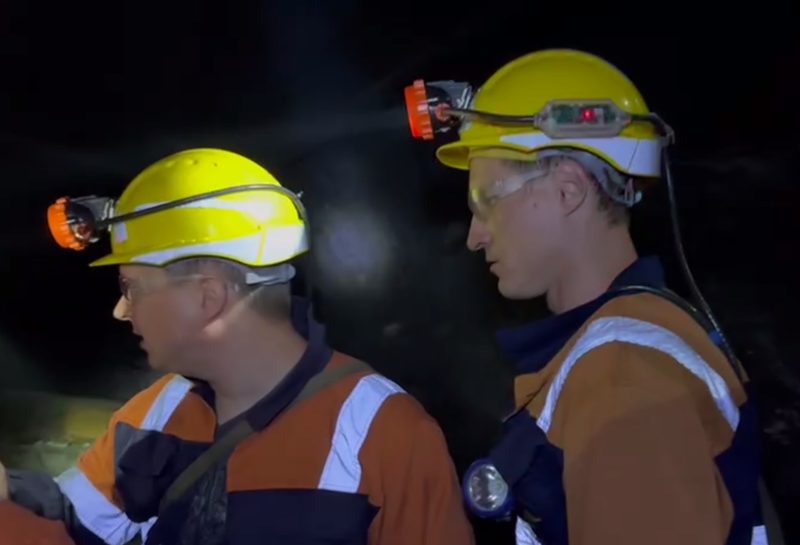
Learn more about the productThe product determines the location of miners, mining vehicles and other objects on different mine levels, at working faces and in mine workings using BLE, UWB and UHF radio technologies. Tags are built into cap lamps, vehicle tags are mounted on vehicles, and access points are installed at key locations in the mine and transmit data in real time.
Tasks solved
Miner access level control
Geofences with different access levels: the dispatcher always knows whether a miner is in a permitted or prohibited zone; reports reveal systematic violations.
Location control in mine workings
Current location of all miners and mining vehicles and the route an object has traveled over a given period.
Working time control
Registration of geofence entry and exit, control of presence on mine levels and in working areas, notification that it is time to return to the surface; data is stored for up to 10 years.
Emergency notification of miners
Global, group and individual alarms sent to tags; control of sirens and emergency lighting.
Evacuation and locating trapped personnel
Real-time evacuation control: time, routes and location of those who have not reached safe assembly points; last known location before loss of communication.
Two types of positioning
Zonal positioning (±25 m)
A basic safety tool
- Fast location of people and vehicles in emergencies
- Last known location of people and vehicles before loss of communication
- Basic efficiency analysis: movements between zones over a period
- Global alarm from the control center to all tags and individual notification of a specific miner
- Few access points and low implementation costs
Precise positioning along the mine graph (±1 m)
A tool for higher efficiency and safety
- Real-time digital twin of the mine: full transparency of personnel and vehicle activity for management
- Plan-vs-actual analysis of shift assignments: where people were supposed to work and where they actually were, response time to requests
- Analysis of personnel and vehicle movement efficiency
- Control that no people are present in hazardous zones and on conveyors
- Denser access point network in hazardous zones
Positioning equipment
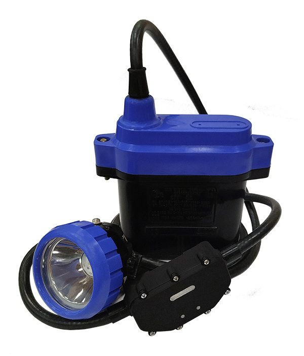
PROD TAG 411 personal tag
- BLE, UWB, UHF: zonal (~20 m) or precise (1 m) positioning
- Built into cap lamps, including lamps with gas monitoring; powered by the lamp battery
- Fall and immobility detection, panic button, audible alert
- Supports RealTrac CAS; connects third-party equipment via BLE
- IP67, −40…+45 °C, under 100 g
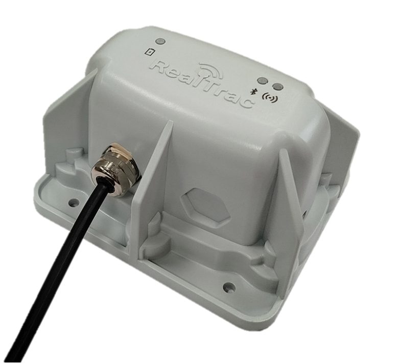
PROD POINT 520 mine access point
- BLE, UWB, UHF: zonal (~20 m) and precise (~0.5 m) positioning, vertical position detection
- Data exchange with tags at up to 100 m over UHF, 1 s update interval
- PoE power, Ethernet data transmission
- IP67, −40…+45 °C, housing 164×149×76 mm
- The access point network is reused for IP video surveillance and SIP telephony
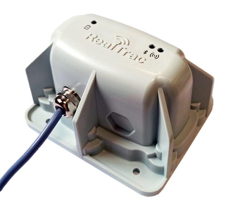
PROD VTAG 201 vehicle tag
- Vehicle positioning and RealTrac CAS support: UWB (1 m), BLE (~20 m), GNSS (3 m)
- Can be installed temporarily; powered by the 8–30 V on-board supply or a built-in battery (over 8 hours)
- Collection of vehicle telemetry
- IP69, −40…+45 °C
Software
Learn more about the softwareRealTrac Server: calculation and storage of tag location data, analytical reports, alarms to the control room (man-down, hazardous zone violation, panic button), emergency notification (global, group and individual alarms), integration with dispatching, process control systems (SCADA), the fleet management system, video surveillance and fleet operations. Runs on free software with no additional licensing, open protocol (API), several mines and processing plants on one server; the server can be on site, off site or in the cloud.
RealTrac Client: a thin client with no installation on the dispatcher's workstation, visualization of current data, analytics and a report builder, metrics and business processes based on geofences, separate access levels, connection to a remote server.
Data network backbone and seamless Wi-Fi
The mine's data network backbone combines wired and wireless technologies. Switching nodes (an Ethernet switch with PoE and a UPS, powered from the 127 V supply) are connected in a ring by a fiber-optic line: a break in one line does not interrupt communication, and each fiber-optic span is divided into 50 m segments, so after a break a whole segment is replaced without splicing. UWB and Wi-Fi points are connected to each node.
- UWB points are installed every ~90 m; positioning accuracy is 1 m.
- Wi-Fi points are installed every ~250 m; data rate of at least 10 Mbit/s; any Wi-Fi-enabled equipment can be connected.
- Redundant data links (copper lines, fiber optics, Wi-Fi) and power supply at the switching node level.
- Monitoring of all network elements for uninterrupted operation and predictive failure analytics.
Seamless Wi-Fi network in an underground mine
Functions: seamless handover of PoC terminals and smartphones between Wi-Fi access points, transmission of vehicle telemetry, transmission of camera data.
- IEEE 802.11a/b/g/n/ac/ax, operating frequencies 2.4 and 5 GHz.
- Data rate: up to 574 Mbit/s at 2.4 GHz, up to 2402 Mbit/s at 5 GHz.
- 2×2 MIMO in both bands; handover between access points every 100–200 m.
Voice and telephone communications
Wireless voice communications
Digital push-to-talk over cellular (PoC) radios on 2.4 / 5 GHz Wi-Fi and LTE networks: work outdoors and indoors, with a screen, in an IP68 housing; an optional video recorder. Seamless handover between Wi-Fi access points.
Wired telephone communications
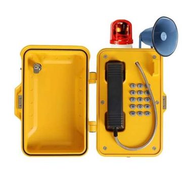
All-weather vandal-resistant industrial SIP phone with a protective cover, loudspeaker and beacon light: cast aluminum housing, IK10, IP67, mean time between failures over 50,000 hours, −40…+65 °C, SIP 2.0, two Ethernet ports. Recommended for mines, metro systems, tunnels and plants.
RealTrac Collision Avoidance System (CAS) module
Learn more about the productRealTrac CAS is designed to reduce accidents caused by collisions between vehicles and machinery, as well as vehicles hitting miners in poor or limited visibility. RealTrac CAS not only warns pedestrians and drivers but also brakes the vehicle automatically, does not disturb the driver with false alarms, works indoors and outdoors and notifies the operator of faults.
Vehicle to vehicle. Safe traffic in poor visibility, less downtime and fewer repairs after collisions: dangerous approaches are detected and the driver or operator is alerted.
Vehicle to person. Fewer injuries from vehicles hitting people and safe maneuvering where people gather: the incident is recorded and an alert is issued when a miner is in a hazardous zone.
Advantages
Minimal false alarms
Precise positioning of objects around the vehicle and flexible configuration of zone size and shape, taking into account the vehicle type and direction of travel.
Fully autonomous
Does not depend on stable power supply or satellite communications.
Underground and on the surface
Works the same way in mine workings, maintenance areas and open sites with the same equipment.
Short- and long-range detection
UWB for precise direction and distance to nearby objects, UHF for detection at up to 200 m, including behind obstacles.
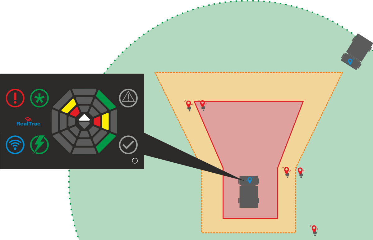
Three control zones
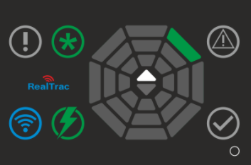
Attention zone
- Warns workers, drivers and operators within the zone radius
- Display: green; tag: intermittent vibration and LED light
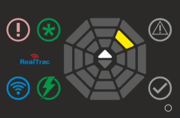
Danger zone
- Reports a dangerous approach and can slow the vehicle down
- Display: yellow and sound; external vehicle alert (option): beacon light, clearance lights; tag: repeated vibration, light and sound
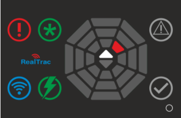
Emergency zone
- Alarm in the most dangerous situations; can stop the vehicle
- Display: red and sound; external vehicle alert (option): beacon light, siren; tag: continuous vibration, light and sound
Seven types of alerts: color and sound of the in-cab display, vibration, sound and light of the tag, and optionally sound and light on the vehicle. The intensity is configured for each control zone.
No needless alarms for the driver: dynamic zones
Optimal zone shape
The zone around the vehicle is narrow at the sides and rear and long in front: it triggers where the vehicle is heading.
Speed-dependent
The faster the vehicle moves, the longer the zone; when parked or with the handbrake on, the zone is minimal.
Direction and boom
Zones adapt to the direction of travel and the position of the working equipment, such as boom extension.
The driver in the cab is ignored
The system stops reacting to the driver's tag in the cab and notifies the operator of equipment faults and dangerous approaches.
RealTrac CAS components
Tags in the cap lamp
The personal tag is built into the miner's cap lamp: alarms by light, sound and vibration, with no additional equipment.
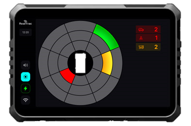
PROD VCD 050 operator display
In the cab: visual overview of the situation around the vehicle, alerts with a recorded audio file, event log, detection of a person in the cab; CAN, Ethernet, dry contacts; IP66; connection of surround view cameras.
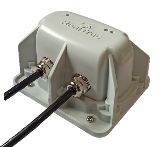
PROD VBU 030 antennas
Mounted on the vehicle body (4–8 units): detection of personal and vehicle tags, UWB accuracy 0.1 m, impact-resistant IP69 housing.
Automatic vehicle slowdown and stop
RealTrac has integrated its vehicle monitoring and management services with a partner's automatic braking system. The solution is based on a collision prevention module that can be installed on any vehicle, including underground mining equipment such as LHD loaders and underground haul trucks. The module works together with the personnel and vehicle tracking system and complements RealTrac CAS: when a risk of collision with a worker is detected, the system automatically applies the vehicle brakes.
- Automatic braking when a person is at risk of being hit.
- A single RealTrac platform for vehicle and personnel monitoring, with transparent analytics of movements and incidents.
- Compatible with any type of vehicle without major modifications.
Telemetry from mining equipment and additional features
Collection and transmission of mining equipment telemetry (option)
- Data from the on-board CAN bus and from external sensors when the data is not available on CAN: engine hours, engine on / off, operation of units, pressure and temperature of hydraulic and air lines.
- Data accumulation and display to the driver, operator and dispatcher; transmission from on-board equipment over the data network to the server.
Additional features and autonomous operation
- Event recording to a black box; transmission of events to the RealTrac server over Wi-Fi or LTE.
- Integration with process control systems (SCADA) and the fleet management system; vehicle control: braking, speed reduction, blocking the start of movement.
- Alerts when approaching infrastructure objects.
- Embedded software and full autonomy from other systems and the data network; with a feedback channel, data on approaches and collisions is sent to the server for analysis and reports.
Work permits module: work execution control and MRO
Learn more about the solutionAn automated system for monitoring work execution: we set the coordinates of maintenance and repair (MRO) objects, monitor deviations and draw conclusions that increase efficiency.
What we know
- Actual labor costs of the work performed.
- Actual completion rate of scheduled work.
- Response time to an identified problem.
- Objective assessment of the cost of work, rest and personnel movement.
- Detection of deviations: duration, labor costs, repeated work.
Deviations we monitor
- Incident response time: from issuing the work order to the actual arrival of the crew.
- Comparison of the actual location of the personnel named in the permit with the plan.
- Detection of a crew's absence from the work site during a given period.
- Plan-vs-actual labor costs at the work site and calculation of the cost of work.
- Occupational health and safety (OHS) deviations: actual crew composition and time of work.
Not only MRO efficiency, but also OHS performance
Monitoring
- Know where employees are
- Fence off hazardous zones and get alerts when they are violated
- Detect dangerous falls
Notification
- Of entry into a hazardous zone and the need to evacuate
- Of an approaching vehicle
- To the operator when the panic button on a tag is pressed
Control
- Time spent in work zones
- Alerts when the permitted time in a zone is exceeded
Advantages of the RealTrac system for underground mining
- A complete solution for underground mines: positioning, RealTrac CAS, communications, data network, traffic lights, search for people trapped under rubble and work permits on a single infrastructure.
- Integration with dispatching and fleet management systems and other enterprise systems.
- Use of the existing mine infrastructure.
- Modular design: functions are added as needed.
- Open protocol (API): data transfer to HR systems, process control systems (SCADA) and others.